Thursday, May 26, 2011


Off to Baku, Azerbaijan.

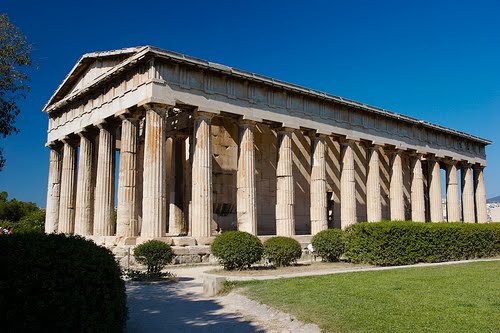
The photos are: 1) the Azerbaijan Carpet Museum; 2) the Nizami Museum of Azerbaijan Literature; 3) Baku Boulevard; 4) The sculpture of Bahram Gur on Azneft Square; 5) the National Assembly of Azerbaijan; 6) The ancient site of Fire Temple at Surakhany and its surroundings; 7) a view of the Azerbaijan State Philharmonic Hall; 8) Baku Port; 9) the Government House of Baku; 10) The 13th century Bibi-Heybat Mosque; 11) the International Mugam Center of Azerbaijan in Baku Boulevard; 12) the Azerbaijan State Philharmonic Hall at night; 13) the Heydar Aliyev Palace; 14) the Baku TV Tower; 15) the Maiden Tower; and 16) the State Academic Opera and Ballet Theater.

Baku, sometimes spelled as Baki or Bakou, is the capital, largest city, and largest port of Azerbaijan and the Caucasus region. It is located on the southern shore of the Absheron Peninsula, that projects into the Caspian Sea. The city consists of two principal parts: the downtown and the old Inner City (21.5 ha). Baku's urban population at the beginning of 2009 was estimated at just over two million people.

Baku is divided into eleven administrative districts (raions) and 48 townships. Among these are the townships on islands in the Baku Bay and the town of Oil Rocks built on stilts in the Caspian Sea, 60 km (37 mi) away from Baku. The Inner City of Baku along with the Shirvanshah's Palace and Maiden Tower were inscribed as a UNESCO World Heritage Site in 2000. According to the Lonely Planet's ranking Baku is also amongst the world's top ten destinations for urban nightlife.

The city also serves as the main economic hub of Azerbaijan. Many sizeable Azerbaijani institutions have their headquarters there, including SOCAR, one of the world's top 100 companies. The Baku International Sea Trade Port, sheltered by the islands of the Baku Archipelago to the east and the Absheron Peninsula to the north, is capable of handling two million tons of general and dry bulk cargoes per year.

The first written evidence for Baku dates to the 1st century AD Much of its history since that time has been linked to various Achaemenid Empire.

The city became important after an earthquake destroyed Shamakhy in the 12th century, when the ruling Shirvanshah, Ahsitan I, chose Baku as the new capital. In 1501, Safavid Shah Ismail I laid siege to Baku. At this time the city was however enclosed within the lines of strong walls, which were washed by the sea on one side and protected by a wide trench on land. In 1540 Baku was again captured by the Safavid troops. In 1604 the Baku fortress was destroyed by Safavid shah Abbas I.

On 26 June 1723, after a lasting siege using cannons, Baku surrendered to the Russians. According to Peter the Great's decree the soldiers of two regiments (2,382 people) were left in the Baku garrison under the command of Prince Baryatyanski, the commandant of the city. In 1795, Baku was invaded by Agha Muhammad Khan Qajar to defend against tsarist Russia's ambitions to subjugate the South Caucasus. In the spring of 1796, by Catherine II's order, General Zubov's troops began a major campaign in Transcaucasia. Baku surrendered after the first demand of Zubov who had sent 6,000 troops to capture the city. On 13 June 1796 the Russian flotilla entered Baku Bay and a garrison of Russian troops was placed in the city. General Pavel Tsitsianov was appointed Baku's commandant. Later, however, Czar Paul I ordered him to cease the campaign and withdraw Russian forces. In March 1797 the tsarist troops left Baku but a new tsar, Alexander I, began to show a special interest in capturing Baku. In 1803, Tsitsianov reached an agreement with the Baku khan to compromise, but the agreement was soon annulled. On 8 February 1806, upon the surrendering of Baku, Huseyngulu khan of Baku stabbed and killed Tsitsianov at the gates of the city.

In 1813, Russia signed the Treaty of Gulistan with Persia, which provided for the cession of Baku and most of the Caucasus from Iran and their annexation by Russia.

Professor A.B. Wiliams Jackson of Columbia University in his work "From Constantinople to the home of Omar Khayyam" (1911) writes: "Baku is a city founded upon oil, for to its inexhaustible founts of naphtha it owes its very existence, its maintenance, its prosperity...At present Baku produces one-fifth of the oil that is used in the world, and the immense output in crude petroleum from this single city far surpasses that in any other district where oil is found.^ Verily, the words of the Scriptures find illustration here : "the rock poured me out rivers of oil."

Oil is in the air one breathes, in one's nostrils, in one's eyes, in the water of the morning bath (though not in the drinking- water, for that is brought in bottles from distant mineral springs), in one's starched linen — everywhere. This is the impression one carries away from Baku, and it is certainly true in the environs."

The first oil well was mechanically drilled in the Bibi-Heybat suburb of Baku in 1846, though a number of hand-dug wells predate it. Large-scale oil exploration started in 1872, when Russian imperial authorities auctioned the parcels of oil-rich land around Baku to private investors. Within a short period of time Swiss, British, French, Belgian, German, Swedish and American investors appeared in Baku, among them were the firms of the Nobel brothers together with the family von Börtzell-Szuch (Carl Knut Börtzell, who also owned the Livadia Palace) and the Rothschild family. An industrial oil belt, better known as Black City, was established near Baku. By the beginning of the 20th century almost half of world production was being extracted in Baku.

In 1917, after the October revolution and amidst the turmoil of World War I and the breakup of the Russian Empire, Baku came under the control of the Baku Commune, which was led by veteran Bolshevik Stepan Shaumyan. Seeking to capitalize on the existing inter-ethnic conflicts, by spring 1918, Bolsheviks inspired and condoned civil warfare in and around Baku. During the infamous March Days, Bolsheviks and Dashnaks seeking to establish control over the Baku streets, faced with armed Muslim groups. Muslims suffered a crushing defeat by the united forces of the Baku Soviet and then felt the whole unbridled ferocity of Dashnak teams. Some 12 000 Azeri became the victims of the massacre carried out by radical Armenians and Bolshevik troops.

On 28 May 1918, the Azerbaijani faction of the Transcaucasian Sejm proclaimed the independent Azerbaijan Democratic Republic (ADR) in Ganja. Shortly after, Azerbaijani forces, with support of the Ottoman Army of Islam led by Nuru Pasha, started their advance into Baku, eventually capturing the city from the loose coalition of Bolsheviks, Esers, Dashnaks, Mensheviks and British forces under the command of General Lionel Dunsterville on 15 September 1918. Thousands of Armenians in the city were massacred in revenge for the earlier March Days. Baku became the capital of the ADR. On 28 April 1920, the 11th Red Army invaded Baku and reinstalled the Bolsheviks, making Baku the capital of the Azerbaijan Soviet Socialist Republic.

The city has many amenities that offer a wide range of cultural activities, drawing both from a rich local dramatic portfolio and an international repertoire. It also boasts many museums, most notably featuring historical artifacts and art. Many of the city's cultural sites were celebrated in 2009 when Baku was designated an Islamic Culture Capital. Baku also chosen to host Eurovision Dance Contest 2010.

Among Baku's prestigious cultural venues are Azerbaijan State Philharmonic Hall, Azerbaijan State Academic Opera and Ballet Theatre. The main movie theatre is Azerbaijan Cinema. Festivals include the Baku International Film Festival, Baku International Jazz Festival, Novruz Festival, Gül Bayramı (Flower Festival) and the National Theater Festival. International and local exhibitions are provided in Baku Expo Center.

Baku has wildly varying architecture, ranging from the Old City core to modern buildings and the spacious layout of Baku port. Many of the city's most impressive buildings were built during the Azerbaijan Democratic Republic period, when architectural elements of the European styles were combined in eclectic style.Baku thus has an original and unique appearance, earning it a reputation as the 'Paris of the East'.

Late modern and postmodern architecture began to appear in the early 2000s. With economic development, old buildings such as Atlant House were razed to make way for new ones. Buildings with all-glass shells have appeared around the city, the most prominent examples being the SOCAR Tower and Flame Towers. These projects also brought attention of international media as notable programs as Discovery Channel's Extreme Engineering featured changes in the city.

Most of the walls and towers, strengthened after the Russian conquest in 1806, survived. This section is picturesque, with its maze of narrow alleys and ancient buildings: the cobbled streets past the Palace of the Shirvanshahs, two caravansaries, the baths and the Juma Mosque (which used to house the Azerbaijan National Carpet and Arts Museum, but is now a mosque again). The old town core also has dozens of small mosques, often without any particular sign to distinguish them as such.

In 2003, UNESCO placed the Inner City on the List of World Heritage in Danger, citing damage from a November 2000 earthquake, poor conservation as well as "dubious" restoration efforts.

Baku has large sections of greenery either preserved by the National Government or designated as green zones. The city, however, continues to lack a green belt development as economic activity pours into the capital, resulting in massive housing projects along the suburbs.

Baku Boulevard is a pedestrian promenade that runs parallel to Baku's seafront. The boulevard contains an amusement park, yacht club, musical fountain, statues and monuments. The park is popular with dog-walkers and joggers, and is convenient for tourists. It is adjacent to the newly built International Center of Mugham and the musical fountain.

Other prominent parks and gardens include Heydar Aliyev Park, Samad Vurgun Park, Narimanov Park, Alley of Honor and the Fountains Square. The Martyrs' Lane, formerly the Kirov Park, is dedicated to the memory of those who lost their lives during the Nagorno-Karabakh War and also to the 137 people killed on Black January.

Baku boasts a vibrant nightlife. Many clubs that are open until dawn can be found throughout the city. Clubs with an eastern flavor provide special treats of cuisine of Azerbaijan along with local music. Western-style clubs target younger, more energetic crowds. Most of the public houses and bars are located near Fountains Square and are usually open until the early hours of the morning.

Baku is home to restaurants catering to every cuisine and occasion. Restaurants range from being luxurious and expensive to ordinary and affordable.

In the Lonely Planet "1000 Ultimate Experiences", Baku was placed at the 8th spot among the top 10 party cities in the world.

The music scene in Baku can be traced back to ancient times and villages of Baku, generally revered as the fountainhead of meykhana and mugham in the Azerbaijan.

In recent years, the success of Azerbaijani performers such as AySel, Safura, Elnur Hüseynov and Arash in Eurovision has significantly boosted the profile of the Baku music scene, prompting international attention. Following the victory of Azerbaijan's representative Eldar & Nigar at the Eurovision Song Contest 2011, Baku will host the Eurovision Song Contest 2012.

2005 was a landmark in the development of jazz in the city. It has been home to legendary jazz musicians like Vagif Mustafazadeh, Aziza Mustafa Zadeh, Rafig Babayev and Rain Sultanov. Among Baku's prominent annual fairs and festivals is Baku International Jazz Festival, which includes the world's most identifiable jazz names.
Baku also has a thriving International Center of Mugham, which is located in Baku Boulevard and Buta Palace, one of the principal performing arts centers and music venues in the city.

The majority of Azerbaijan's media companies (including television, newspaper and radio, such as ANS, Azad Azerbaijan TV, Ictimai TV or Lider TV) are headquartered in Baku. The films The World Is Not Enough and The Diamond Arm are set in the city, while Amphibian Man includes several scenes filmed in Old City.

Out of the city's radio stations ANS ChM, Ictimai Radio, Radio Antenn, Burc FM, and Lider FM Jazz are some of the more influential competitors with large national audiences. ANS ChM was one of the first private and independent FM radio broadcasting service in the Caucasus and Central Asia regions when it was established in May 1994.

Wednesday, May 25, 2011


Today we are going to visit Baghdad.

The photos are: 1) the Baghdad skyline with the Sheraton Ishtar; 2) Haifa Street, as seen from the Medical City Hospital across the Tigris River; 3) Qasr-Al-Khalifa or Abbasid Palace in Samarra; 4) the National Museum of Iraq; 5) a panoramic view of the ancient city of Babylon; 6) Baghdad International Airport; 7) Albunneya mosque in Al-Alawi district Baghdad; 8) Baghdad Tower; 9) Suq al-Ghazel (the Yarn Bazaar) Minaret; and 10) the Monument to the Unknown Soldier.

Baghdad is the capital of Iraq, as well as the coterminous Baghdad Governorate. With an estimated population between 7 and 7.5 million, it is the largest city in Iraq, the second largest city in the Arab World (after Cairo, Egypt), and the second largest city in Western Asia (after Tehran, Iran).

Located along the Tigris River, the city was founded in the 8th century and became the capital of the Abbasid Caliphate. Within a short time of its inception, Baghdad evolved into a significant cultural, commercial, and intellectual center for the Islamic World. This in addition to housing several key academic institutions (e.g. House of Wisdom) garnered the city a worldwide reputation as the "Center of Learning". Throughout the High Middle Ages, Baghdad was considered to be the largest city in the world with an estimated population of 1,200,000 people.[3] The city was largely destroyed at the hands of the Mongol Empire in 1258, resulting in a decline that would linger through many centuries due to frequent plagues and multiple successive empires. With the recognition of Iraq as an independent state (formerly the British Mandate of Mesopotamia) in 1938, Baghdad gradually regained some of its former prominence as a significant center of Arabic culture.

In contemporary times the city has often faced severe infrastructural damage, most recently due to the U.S.-led invasion of Iraq in 2003 and the subsequent state of war that lasted until 2010. The city is a frequent subject to insurgency activities and terrorist attacks.

In 762, Baghdad was established as a city by Abu Ja'far Abdallah ibn Muhammad al-Mansur. On 30 July 762 the caliph Al Mansur commissioned the construction of the city and it was built under the supervision of the Barmakids. Mansur believed that Baghdad was the perfect city to be the capital of the Islamic empire under the Abbasids. Mansur loved the site so much he is quoted saying, "This is indeed the city that I am to found, where I am to live, and where my descendants will reign afterward".

The city's growth was helped by its location, which gave it control over strategic and trading routes, along the Tigris. A reason why Baghdad provided an excellent location was the abundance of water and the dry climate. Water exists on both north and south ends of the city gates, allowing all households to have a plentiful supply, which was very uncommon during this time.

Baghdad eclipsed Ctesiphon, the capital of the Persian Empire, which was located some 30 km (19 mi) to the southeast. Today, all that remains of Ctesiphon is the shrine town of Salman Pak, just to the south of Greater Baghdad. Ctesiphon itself had replaced and absorbed Seleucia, the first capital of the Seleucid Empire. Seleucia had earlier replaced the city of Babylon.

In its early years the city was known as a deliberate reminder of an expression in the Qur'an, when it refers to Paradise. Four years before Baghdad's foundation, in 758, Mansur assembled engineers, surveyors, and art constructionists from around the world to come together and draw up plans for the city. Over 100,000 construction workers came to survey the plans; many were distributed salaries to start the building of the city. July was chosen as the starting time because two astronomers, Naubakht Ahvaz and Mashallah, believed that the city should be built under the sign of the lion, Leo. Leo is associated with fire and symbolises productivity, pride, and expansion.

The bricks used to make the city were 18 inches (460 mm) on all four sides. Abu Hanifa was the counter of the bricks and he developed a canal, which brought water to the work site for the use of both human consumption and the manufacturing of the bricks. Marble was also used to make buildings throughout the city, and marble steps led down to the river's edge.

The basic framework of the city consists of two large semicircles about 19 km (12 miles) in diameter. The city was designed as a circle about 2 km in diameter, leading it to be known as the "Round City". The original design shows as single ring of residential and commercial structures along the inside of the city walls, but the final construction added another ring inside the first. Within the city there were many parks, gardens, villas, and promenades. In the center of the city lay the mosque, as well as headquarters for guards. The purpose or use of the remaining space in the center is unknown. The circular design of the city was a direct reflection of the traditional Persian Sasanian urban design. The Sasanian city of Gur in Fars, built 500 years before Baghdad, is nearly identical in its general circular design, radiating avenues, and the government buildings and temples at the centre of the city. This style of urban planning contrasted with Ancient Greek and Roman urban planning, in which cities are designed as squares or rectangles with streets intersecting each other at right angles.

The four surrounding walls of Baghdad were named Kufa, Basra, Khurasan, and Damascus; named because their gates pointed in the directions of these destinations. The distance between these gates was a little less than 1.5 miles (2.4 km). Each gate had double doors that were made of iron; the doors were so heavy it took several men to open and close them. The wall itself was about 44 m thick at the base and about 12 m thick at the top. Also, the wall was 30 m high, which included merlons, a solid part of an embattled parapet usually pierced by embrasures. This wall was surrounded by another wall with a thickness of 50 m. The second wall had towers and rounded merlons, which surrounded the towers. This outer wall was protected by solid glacis, whichut of bricks and quicklime. Beyond the outer wall was a water filled moat.

In the middle of Baghdad, in the central square was the Golden Gate Palace. The Palace was the residence of the caliph and his family. In the central part of the building was a green dome that was 39 m high. Surrounding the palace was an esplanade, a waterside building, in which only the caliph could come riding on horseback. In addition, the palace was near other mansions and officer's residences. Near the Gate of Syria a building served as the home for the guards. It was made of brick and marble. The palace governor lived in the latter part of the building and the commander of the guards in the front. In 813, after the death of caliph Al-Mansur the palace was no longer used as the home for the caliph and his family. The roundness points to the fact that it was based on Arab. The two designers who were hired by al-Mansur to plan the city's design were Naubakht, a Zoroastrian who also determined that the date of the foundation of the city would be astrologically auspicious, and Mashallah, a Jew from Khorasan, Iran.

The Abbasid Caliphate was based on their being the descendants of the uncle of Muhammad and being part of the Quraysh tribe. They used Shi'a resentment, Khorasanian movement, and appeals to the ambitions and traditions of the newly conquered Persian aristocracy to overthrow the Umayyads. The Abbasids sought to combine the hegemony of the Arabic tribes with the imperial, court, ceremonial, and administrative structures of the Persians. The Abbasids considered themselves the inheritors of two traditions: the Arabian-Islamic (bearers of the mantle of Muhammad) and the Persian (successors to the Sassanid monarchs). These two things are evident from the construction, which is modeled after Persian structures and the need of Mansur to place the capital in a place that was representative of Arab-Islamic identity by building the House of Wisdom, where ancient texts were translated from their original language, such as Greek, to Arabic. Mansur is credited with the "Translation Movement" for this. Further, Baghdad is also near the ancient Sassanid imperial seat of Ctesiphon on the Tigris River.

Within a generation of its founding, Baghdad became a hub of learning and commerce. The House of Wisdom was an establishment dedicated to the translation of Greek, Middle Persian and Syriac works. Scholars headed to Baghdad from all over the Abbasid empire, facilitating the introduction of Greek and Indian science into the Arabic and Islamic world at that time. Baghdad was likely the largest city in the world from shortly after its foundation until the 930s, when it was tied by Córdoba. Several estimates suggest that the city contained over a million inhabitants at its peak. Many of the One Thousand and One Nights tales are set in Baghdad during this period.

By the 10th century, the city's population was between 1.2 million and 2 million. Baghdad's early meteoric growth eventually slowed due to troubles within the Caliphate, including relocations of the capital to Samarra (during 808–819 and 836–892), the loss of the western and easternmost provinces, and periods of political domination by the Iranian Buwayhids (945–1055) and Seljuk Turks (1055–1135).

The Seljuks were a clan of the Oghuz Turks from the Siberian steppes that converted to the Sunni branch of Islam. In 1040, they destroyed the Ghaznavids, taking over their land and in 1055, Tughril Beg, the leader of the Seljuks, took over Baghdad. The Seljuks expelled the Buyids dynasty of Shiites that ruled for some time and took over power and control of Baghdad. They ruled as Sultans in the name of the Abbasid caliphs (they saw themselves as being part of the Abbasid regime) Tughril Beg saw himself as the protector of the Abbasid Caliphs.

In 1058, Baghdad was captured by the Fatimids under the Turkish general Abu'l-Ḥārith Arslān al-Basasiri, an adherent of the Ismailis along with the 'Uqaylid Quraysh. Not long before the arrival of the Saljuqs in Baghdad, al-Basasiri petitioned to the Fatimid Imam-Caliph al-Mustansir to support him in conquering Baghdad on the Ismaili Imam's behalf. It has recently come to light that the famed Fatimid da'i al-Mu'ayyad al-Shirazi had a direct role in supporting al-Basasiri and helped the general to succeed in taking Mawṣil, Wāsit and Kufa. Soonafter, By December 1058, a Shi'i adhān (call to prayer) was implemented in Baghdad and a khutba (sermon) was delivered in the name of the Fatimid Imam-Caliph. Despite his Shi'i inclinations, Al-Basasiri received support from Sunnis and Shi'is alike, for whom opposition to the Saljuq power was a common factor.

On February 10, 1258, Baghdad was captured by the Mongols led by Hulegu, a grandson of Chingiz Khan (Genghis Khan) during the sack of Baghdad. Many quarters were ruined by fire, siege, or looting. The Mongols massacred most of the city's inhabitants, including the caliph Al-Musta'sim, and destroyed large sections of the city. The canals and dykes forming the city's irrigation system were also destroyed. The sack of Baghdad put an end to the Abbasid Caliphate, a blow from which the Islamic civilization never fully recovered.

At this point Baghdad was ruled by the Il-Khanids, the Mongol emperors of Iran. In 1401, Baghdad was again sacked, by Timur ("Tamerlane"). When his forces took Baghdad, he spared almost no one, and ordered that each of his soldiers bring back two severed human heads. It became a provincial capital controlled by the Jalayirid (1400–1411), Kara Koyunlu (1411–1469), Ak Koyunlu (1469–1508), and the Iranian Safavid (1508–1534) dynasties.

In 1534, Baghdad was captured by the Ottoman Turks. Under the Ottomans, Baghdad fell into a period of decline, partially as a result of the enmity between its rulers and Safavid Turks, which did not accept the Sunni control of the city. Between 1623 and 1638, it returned briefly to Iranian rule before falling back into Ottoman hands.

Baghdad has suffered severely from visitations of the plague and cholera, and sometimes two-thirds of its population has been wiped out.

For a time, Baghdad had been the largest city in the Middle East. The city saw relative revival in the latter part of the 18th century under a Mamluk government. Direct Ottoman rule was reimposed by Ali Ridha Pasha in 1831. From 1851-1852 and from 1861–1867, Baghdad was governed, under the Ottoman Empire by Mehmed Namık Pasha. The Nuttall Encyclopedia reports the 1907 population of Baghdad as 185,000. Aside from ethnically Arab Iraqis, the city was also home to a substantial ancient Jewish community, which comprised over a quarter of the city's population (this proportion would grow in later years)

Baghdad and southern Iraq remained under Ottoman rule until 1917, when captured by the British during World War I. From 1920, Baghdad became the capital of the British Mandate of Mesopotamia and, after 1932, Baghdad was the capital of the Kingdom of Iraq. Iraq was given formal independence in 1932 and increased autonomy in 1946. The city's population grew from an estimated 145,000 in 1900 to 580,000 in 1950 of which 140,000 (nearly a quarter) were Jewish. In the 1920s, Baghdad was 40 percent Jewish. Jews made up the largest single community in the city and controlled up to 95 per cent of business. Baghdad was also home to many prominent Jewish figures, such as Sassoon Eskell.

On 1 April 1941 members of the "Golden Square" and Rashid Ali staged a coup in Baghdad. Rashid Ali installed a pro-German and pro-Italian government to replace the pro-British government of Regent Abdul Ilah. On 31 May, after the resulting Anglo-Iraqi War and after Rashid Ali and his government had fled, the Mayor of Baghdad surrendered to British and Commonwealth forces. After the collapse, a pogrom (Farhud) took place against the Jewish population of Bagdhad, where around 175 Jews had been killed, one thousand injured, and 900 Jewish homes were destroyed.

On 14 July 1958, members of the Iraqi Army under Abdul Karim Kassem staged a coup to topple the Kingdom of Iraq. King Faisal II, former Prime Minister Nuri al-Said, former Regent Prince Abdul Ilah, members of the royal family, and others were brutally killed during the coup. Many of the victim's bodies were then dragged through the streets of Baghdad.

During the 1970s, Baghdad experienced a period of prosperity and growth because of a sharp increase in the price of petroleum, Iraq's main export. New infrastructure including modern sewerage, water, and highway facilities were built during this period. However, the Iran–Iraq War of the 1980s was a difficult time for the city, as money was diverted by Saddam Hussein to the army and thousands of residents were killed. Iran launched a number of missile attacks against Baghdad.

In 1991 and 2003, the Gulf War and the 2003 invasion of Iraq caused significant damage to Baghdad's transportation, power, and sanitary infrastructure as the US-led coalition forces launched massive aerial assaults in the city in the two wars.

Tuesday, May 24, 2011


Let's go to Avarua in the Cook Islands. Not a lot on Avarua so I will put something in about the Cook Islands as well.

The photos are: 1) a beach on Rarotonga; 2) a float parade during the annual Maeva Nui celebrations; 3) the mountains of the East Coast; 4) an Avarua Market; 5) the beach at Paradise Inn; 6) the Parliament Building of the Cook Islands; and 7) Ara Maire Nui, the main street in Avarua.

Avarua is a town and district in the north of Rarotonga Island, the national capital of Cook Islands. It is equivalent to Te-au-o-tonga, one of three vaka (traditional tribal areas of Rarotonga) and had its own local government headed by a mayoress until its legal abolishment in February 2008.

The downtown area is located at sea level, below the towering peaks of Rarotonga (altitude 208 m). The town has several supermarkets, two banks, several restaurants and other shops specializing in the sale of black pearls and other handicrafts. The town's open air market is on Saturday, where you can find everything from brightly coloured pare'u (wrap around dresses), to flower garlands, fresh fish and tropical fruits. The town is served by Rarotonga International Airport. The population of Avarua District is 5,445 (census of 2006), who mainly make their living from tourism, trade, fishing and agriculture. The one main road in Avarua is Ara Maire Nui, usually referred to as Marine Drive or Main Street, which turns into the island-circling ring road Ara Tapu at both ends of town.

The Cook Islands are in the South Pacific Ocean, north-east of New Zealand, between French Polynesia and American Samoa. There are 15 major islands, spread over 2.2 million km² of ocean, divided into two distinct groups: the Southern Cook Islands, and the Northern Cook Islands of coral atolls. The islands were formed by volcanic activity; the northern group is older and consists of six atolls (sunken volcanoes topped by coral growth). The climate is moderate to tropical.

The Cook Islands were first settled in the 6th century CE by Polynesian people who migrated from nearby Tahiti, to the southeast. Spanish ships visited the islands in the 16th century; the first written record of contact with the Islands came with the sighting of Pukapuka by Spanish sailor Álvaro de Mendaña de Neira in 1595 who called it San Bernardo (Saint Bernard). Portuguese-Spaniard Pedro Fernández de Quirós, made the first recorded European landing in the islands when he set foot on Rakahanga in 1606, calling it Gente Hermosa (Beautiful People).

British navigator Captain James Cook arrived in 1773 and 1777 and named the islands the Hervey Islands; the name "Cook Islands", in honour of Cook, appeared on a Russian naval chart published in the 1820s.

In 1813, John Williams, a missionary on the Endeavour (not the same ship as that of Cook), made the first official sighting of the island of Rarotonga. The first recorded landing on Rarotonga by Europeans was in 1814 by the Cumberland; trouble broke out between the sailors and the Islanders and many were killed on both sides. The islands saw no more Europeans until missionaries arrived from England in 1821. Christianity quickly took hold in the culture and many islanders continue to be Christian believers today.

The Cook Islands became a British protectorate in 1888, due largely to community fears that France might occupy the territory as it had Tahiti. In 1901, the New Zealand Government decided to annex the country despite opposition from the country's traditional chiefs. As many of the islands were independent and ruled by local chiefs, the Cook Islands had no federal statutory law to decide the constitutional constraints regarding whether to agree to the country's annexation by the New Zealand Government. Nonetheless, the country remained a New Zealand protectorate until 1965, when the New Zealand Government decided to offer self governing status to its former colony. In that year, Albert Henry of the Cook Islands Party was elected as the first Prime Minister. Sir Albert Henry led the country until he was accused of vote-rigging. He was succeeded in 1978 by Tom Davis of the Democratic Party.

Today, the Cook Islands are essentially independent ("self-governing in free association with New Zealand") but New Zealand is tasked with overseeing the country's defence.

On 11 June 1980, the United States signed a treaty with the Cook Islands specifying the maritime border between the Cook Islands and American Samoa and also relinquishing its claim to the islands of Penrhyn, Pukapuka, Manihiki, and Rakahanga. In 1990 the Cook Islands signed a treaty with France which delimited the boundary between the Cook Islands and French Polynesia.

Woodcarving is a common art form in the Cook Islands. Sculpture in stone is much rarer although there are some excellent carvings in basalt by Mike Tavioni. The proximity of islands in the southern group helped produce a homogeneous style of carving but which had special developments in each island. Rarotonga is known for its fisherman's gods and staff-gods, Atiu for its wooden seats, Mitiaro, Ma'uke and Atiu for mace and slab gods and Mangaia for its ceremonial adzes. Most of the original wood carvings were either spirited away by early European collectors or were burned in large numbers by missionary zealots. Today, carving is no longer the major art form with the same spiritual and cultural emphasis given to it by the Maori in New Zealand. However, there are continual efforts to interest young people in their heritage and some good work is being turned out under the guidance of older carvers. Atiu, in particular, has a strong tradition of crafts both in carving and local fibre arts such as tapa. Mangaia is the source of many fine adzes carved in a distinctive, idiosyncratic style with the so-called double-k design. Mangaia also produces food pounders carved from the heavy calcite found in its extensive limestone caves.

The outer islands produce traditional weaving of mats, basketware and hats. Particularly fine examples of rito hats are worn by women to church. They are made from the uncurled immature fibre of the coconut palm and are of very high quality. The Polynesian equivalent of Panama hats, they are highly valued and are keenly sought by Polynesian visitors from Tahiti. Often, they are decorated with hatbands made of minuscule pupu shells which are painted and stitched on by hand. Although pupu are found on other islands the collection and use of them in decorative work has become a speciality of Mangaia. The weaving of rito is a speciality of the northern island of Penrhyn.

A major art form in the Cook Islands is tivaevae. This is, in essence, the art of handmade Island scenery patchwork quilts. Introduced by the wives of missionaries in the 19th century, the craft grew into a communal activity and is probably one of the main reasons for its popularity.

The Cook Islands has produced internationally recognised contemporary artists, especially in the main island of Rarotonga. Artists include painter (and photographer) Mahiriki Tangaroa, sculptors Eruera (Ted) Nia (originally a film maker) and master carver Mike Tavioni, painter (and Polynesian tattoo enthusiast) Upoko’ina Ian George, Aitutakian-born painter Tim Manavaroa Buchanan, Loretta Reynolds, Judith Kunzlé, Joan Rolls Gragg, Kay George (who is also known for her fabric designs), Apii Rongo, and multi-media, installation and community-project artist Ani O'Neil, all of whom currently live on the main island of Rarotonga. Atiuan-based Andrea Eimke is an artist who works in the medium of tapa and other textiles, and also co-authored the book 'Tivaivai - The Social Fabric of the Cook Islands' with British academic Susanne Kuechler. Many of these artists have studied at university art schools in New Zealand and continue to enjoy close links with the New Zealand art scene.

On Rarotonga, the main commercial galleries are Beachcomber Contemporary Art (Taputapuatea, Avarua) run by Ben Bergman, and The Art Gallery ('Arorangi). The Cook Islands National Museum also exhibits art.

Monday, May 23, 2011


We are going to one of the world's most famous cities - Athens.

The photos are: 1) a panoramic view of the Parthenon; 2) a panoramic view of Kolonaki Square; 3) the Temple of Hephaestus; 4) the Zappeion in the National Gardens of Athens; 5) Omonoia Square; 6) Plaka, the old historical neighborhood of Athens; 7) the Hellenic Parliament; 8) the Acropolis Museum; 9) the Acropolis; 10) the Temple of Zeus; 11) the Philopappos Monument; and 11) a statue of Athena at the Academy of Athens.

Athens is the capital and largest city of Greece. Athens dominates the Attica periphery and it is one of the world's oldest cities, as its recorded history spans around 3,400 years.

The Greek capital has a population of 745,514 (in 2001) within its administrative limits and a land area of 39 km2 (15 sq mi). The urban area of Athens extends beyond the administrative city limits with a population of 3,130,841 (in 2001 and a land area of 412 km2 (159 sq mi). According to Eurostat, the Athens Larger Urban Zone (LUZ) is the 7th most populous LUZ in the European Union (the 4th most populous capital city of the EU) with a population of 4,013,368 (in 2004).

A cosmopolitan metropolis, modern Athens is central to economic, financial, industrial, political and cultural life in Greece and it is rated as an alpha- world city. In 2008, Athens was ranked the world's 32nd richest city by purchasing power and the 25th most expensive in a UBS study.

Classical Athens was a powerful city-state. A centre for the arts, learning and philosophy, home of Plato's Academy and Aristotle's Lyceum, it is widely referred to as the cradle of Western civilization and the birthplace of democracy, largely due to the impact of its cultural and political achievements during the 5th and 4th centuries BC on the rest of the then known European continent.

The heritage of the classical era is still evident in the city, represented by a number of ancient monuments and works of art, the most famous of all being the Parthenon, widely considered a key landmark of early Western civilization. The city also retains a vast variety of Roman and Byzantine monuments, as well as a smaller number of remaining Ottoman monuments projecting the city's long history across the centuries. Athens is home to two UNESCO World Heritage Sites, the Acropolis of Athens and the medieval Daphni Monastery. Landmarks of the modern era, dating back to the establishment of Athens as the capital of the independent Greek state in 1833, include the Hellenic Parliament (19th century) and the Athens Trilogy consisting of the National Library of Greece, the Athens University and the Academy of Athens. Athens was the host city of the first modern-day Olympic Games in 1896, and 108 years later it welcomed home the 2004 Summer Olympics. Athens is home to the National Archeological Museum, featuring the world's largest collection of ancient Greek antiquities, as well as the new Acropolis Museum.

The oldest known human presence in Athens is the Cave of Schist which has been dated to between the 11th and 7th millennium BC.[14] Athens has been continuously inhabited for at least 7000 years. By 1400 BC the settlement had become an important centre of the Mycenaean civilization and the Acropolis was the site of a major Mycenaean fortress whose remains can be recognised from sections of the characteristic Cyclopean walls. Unlike other Mycenaean centers, such as Mycenae and Pylos, it is not known whether Athens suffered destruction in about 1200 BC, an event often attributed to a Dorian invasion, and the Athenians always maintained that they were "pure" Ionians with no Dorian element. However, Athens, like many other Bronze Age settlements, went into economic decline for around 150 years following this.

Iron Age burials, in the Kerameikos and other locations, are often richly provided for and demonstrate that from 900 BC onwards Athens was one of the leading centres of trade and prosperity in the region; as were Lefkandi in Euboea and Knossos in Crete. This position may well have resulted from its central location in the Greek world, its secure stronghold on the Acropolis and its access to the sea, which gave it a natural advantage over inland rivals such as Thebes and Sparta.

Classical Athens became the leading city of Ancient Greece in the 5th century BC, with its cultural achievements laying the foundations of Western civilization. It was eventually overcome by its rival city-state of Sparta. By the end of Late Antiquity the city experienced decline followed by recovery in the second half of the Middle Byzantine Period (9th–10th centuries AD), and was relatively prosperous during the Crusades, benefiting from Italian trade. In 1453 it was conquered by the Ottoman Empire and entered a long period of decline.

Following the Greek War of Independence, Athens was chosen as the capital of the newly independent Greek state in 1834, largely due to historical and sentimental reasons. At the time it was a town of modest size built around the foot of the Acropolis. The first King of Greece, Otto of Bavaria, commissioned the architects Stamatios Kleanthis and Gustav Schaubert to design a modern city plan fit for the capital of a state.

The first modern city plan consisted of a triangle defined by the Acropolis, the ancient cemetery of Kerameikos and the new palace of the Bavarian king (now housing the Greek Parliament), so as to highlight the continuity between modern and ancient Athens. Neoclassicism, the international style of this epoch, was the architectural style through which Bavarian, French and Greek architects such as Hansen, Klenze, Boulanger or Kaftantzoglou designed the first important public buildings of the new capital. In 1896 Athens hosted the first modern Olympic Games. During the 1920s a number of Greek refugees, expelled from Asia Minor after the Greco-Turkish War (1919-1922), swelled Athens' population; nevertheless it was most particularly following World War II, and from the 1950s and 1960s, that the population of the city exploded, and Athens experienced a gradual expansion in all directions. In the 1980s it became evident that smog from factories and an ever increasing fleet of automobiles, as well as a lack of adequate free space due to congestion, had evolved into the city's most important challenge. A series of anti-pollution measures taken by the city's authorities in the 1990s, combined with a substantial improvement of the city's infrastructure (including the Attiki Odos motorway, the expansion of the Athens Metro, and the new Athens International Airport), considerably alleviated pollution and transformed Athens into a much more functional city.

The city of Athens contains a variety of different architectural styles, ranging from Greco-Roman, Neo-Classical, to modern. They are often to be found in the same areas, as Athens is not marked by a uniformity of architectural style. Many of the most prominent buildings of the city are either Greco-Roman or neo-classical in styling. Some of the neo-classical structures to be found are public buildings erected during the mid-19th century, under the guidance of Theophil Freiherr von Hansen and Ernst Ziller, and include the Athens Academy, Athens City Hall, Greek Parliament, Old Parliament (1875–1932) (Now the National Historical Museum), University of Athens, and Zappeion Hall.

Beginning in the 1930s, the International style and other architectural movements such as Bauhaus and Art Deco began to exert an influence on almost all Greek architects, and many buildings both public and private were constructed in accordance with these styles. Localities with a great number of such buildings include Kolonaki, and some areas of the centre of the city; neighbourhoods developed in this period include Kypseli.

In the 1950s and 1960s during the vast extension and development of Athens, modern architecture played a very important role. The centre of Athens was largely rebuilt, leading to the demolition of a number of neoclassical buildings. The architects of this era employed materials such as glass, marble and aluminium, while some blended modern and classical elements. After World War II, internationally known architects to have designed and built in the city included Walter Gropius, with his design for the US Embassy, and, amongst others, Eero Saarinen, in his postwar design for the east terminal of the Ellinikon Airport.

The city is one of the world's main centres of archaeological research. Apart from national institutions, such as Athens University, the Archaeological Society, several archaeological Museums (including the National Archaeological Museum, the Cycladic Museum, the Epigraphic Museum, the Byzantine Museum, as well as museums at the ancient Agora, Acropolis, and Kerameikos), the city is also home to the Demokritos laboratory for Archaeometry as well as several regional and national archaeological authorities that form part of the Greek Department of Culture. Additionally, Athens hosts 17 Foreign Archaeological Institutes which promote and facilitate research by scholars from their respective home countries. As a result, Athens has more than a dozen archaeological libraries and three specialized archaeological laboratories, and is the venue of several hundred specialized lectures, conferences and seminars, as well as dozens of archaeological exhibitions, per year. At any given time, Athens is the (temporary) home to hundreds of international scholars and researchers in all disciplines of archaeology.

The most important museums of Athens include: The National Archaeological Museum, the largest archaeological museum in the country, and one of the most important internationally, as it contains a vast collection of antiquities; its artifacts cover a period of more than 5,000 years, from late Neolithic Age to Roman Greece; The Benaki Museum with its several branches for each of its collections including ancient, Byzantine, ottoman-era and Chinese art and beyond; The Byzantine and Christian Museum, one of the most important museums of Byzantine art; The Numismatic Museum, housing a great collection of ancient and modern coins; The Museum of Cycladic Art, home to an extensive collection of Cycladic art, including the famous figurines made of white marble; and finally the New Acropolis Museum, opened in 2009, and replacing the old museum on the Acropolis. The new museum has proved considerably popular; almost one million people visited during the summer period June–October 2009 alone. A number of smaller and privately owned museums focused on Greek culture and arts are also to be found.

1896 brought forth the revival of the modern Olympic Games, by Frenchman Pierre de Coubertin. Thanks to his efforts, Athens was awarded the first modern Olympic Games. In 1896, the city had an approximate population of 123,000 and the event helped boost the city's international profile. Of the venues used for these Olympics, the Kallimarmaro Stadium, and Zappeion were most crucial. The Kallimarmaro is a replica of the ancient Athenian stadiums, and the only major stadium (in its capacity of 60,000) to be made entirely of white marble from Mount Penteli, the same material used for construction of the Parthenon.


The 1906 Summer Olympics, or the 1906 Intercalated games, were held very successfully in Athens. The intercalated competitions were intermediate games to the internationally organized olympics, and were meant to be organized in Greece. This idea later lost support from the IOC and these games were not made permanent.

Athens was awarded the 2004 Summer Olympics on 5 September 1997 in Lausanne, Switzerland, after having lost a previous bid to host the 1996 Summer Olympics, to Atlanta, United States. It was to be the second time Athens would have the honour of hosting the games, following the inaugural event of 1896. After an unsuccessful bid in 1990, the 1997 bid was radically improved, including an appeal to Greece's Olympic history. In the last round of voting, Athens defeated Rome with 66 votes to 41. Prior to this round, the cities of Buenos Aires, Stockholm and Cape Town had already been eliminated from competition, having received fewer votes.

Friday, May 20, 2011


Okay. Let's head to Asunción.

The photos are: 1) the Asunción skyline; 2) Asunción at night; 3) the Palacio de López (the Lopez Presidential Palace); 4) the Paraguay River and Asunción skyline; 5) an Asunción street with the new buses; 6) the Citibank Tower; 7) the National Pantheon of the Heroes; 8) the Casa de la Independencia (House of the Independence); 9) the Municipal Theater "Ignacio A. Pane"; and 10) the Manzana de la Rivera (a museum-library-theater-cafe complex).

Asunción is the capital and largest city of Paraguay. The Spanish word asunción means assumption in English. It refers to the Assumption of Mary; the full name means The Very Noble and Loyal City of Our Lady Saint Mary of the Assumption.

The "Ciudad de Asunción" is an autonomous capital district not part of any department. The metropolitan area, called Gran Asunción, includes the cities of San Lorenzo, Fernando de la Mora, Lambaré, Luque, Mariano Roque Alonso, Ñemby, San Antonio, Limpio, Capiatá and Villa Elisa, which are part of the Central Department. The Asunción metropolitan area has more than 2 million inhabitants. It is the home of the national government, principal port, and the chief industrial and cultural centre of the country. Local manufacturing production includes footwear, textiles, and tobacco products.

Asunción is one of the oldest cities in South America and the longest continually inhabited area in the River Plate Basin; for this reason that it is known as "Mother of Cities". It was from here that the colonial expeditions departed to found other cities, including the second foundation of Buenos Aires and of other important cities such as Villarrica, Corrientes, Santa Fe and Santa Cruz de la Sierra.

The site of the city may have been first visited by Spanish conqueror Juan de Ayolas, on his way north, up the Paraguay River, looking for a passage to the mines of Alto Perú (present-day Bolivia). Later, Juan de Salazar y Espinosa and Gonzalo de Mendoza, relative of Pedro de Mendoza, were sent in search of Ayolas, but were unable to find him. On his way up and then down the river, de Salazar stopped briefly at a bay in the left bank to resupply his ships. He found the natives friendly, and decided to found a fort there, in August, 1537. As customary, he named it according to the religious feast of that day: for August 15, Nuestra Señora de la Asunción (Our Lady of the Assumption), honoring the feast day of the Assumption. This fort became a city with the establishment of the Cabildo (civilian administration) on 16 September 1541.

In 1541, natives destroyed Buenos Aires, and the Spaniards fled to Asunción. Thus, the city became the center of a large Spanish colonial province comprising part of Brazil, present-day Paraguay and northeastern Argentina: the Giant Province of the Indies. In 1603 Asunción was the seat of the First Synod of Asunción, which set guidelines for the evangelization of the natives in their lingua franca, Guaraní.

In 1731, an uprising under José de Antequera y Castro was one of the first rebellions pene against Spanish colonial rule. The uprising failed, but it was the first sign of the independent spirit that was growing among the criollos, mestizos and natives of Paraguay. The event influenced the independence of Paraguay, which then materialised in 1811. The secret reunions between the independence leaders to plan an ambush against the Spanish Governor in Paraguay Bernardo de Velasco were held at the home of Juana María de Lara, in downtown Asunción. On the night of May 14 and May 15 the rebels succeeded and were able to force governor Velasco to surrender. Today, Lara's home is known as Casa de la Independencia (House of the Independence) and serves as a museum and historical building.

After Paraguay became independent, there was significant change in Asunción. Under the presidency of Gaspar Rodríguez de Francia roads were built throughout the city and the streets were named. However, it was during the presidency of Carlos Antonio López that Asunción (and Paraguay) progressed, as the new president implemented new economic policies. More than 400 schools, metallurgic factories and the first railroad service in South America were built during the López presidency. After López died, his son Francisco Solano López became the new president and led the country through the disastrous War of the Triple Alliance that lasted for five years. After the War of the Triple Alliance (1865–70), Asunción was occupied by Brazilian troops until 1876.

Many historians have claimed that this war provoked a steady downfall of the city and country, since it massacred two thirds of the country's population. Progress slowed down greatly afterwards, and the economy remained stagnated.

After the War of the Triple Alliance, Asunción began a slow recovery attempt. Towards the end of the 19th Century and during the early years of the 20th Century, a flow of immigrants from Europe and the Ottoman Empire came to the city. This led to a change in the appearance of the city as many new buildings were built and Asunción went through an era more prosperous than any since the war.

The city has a large number of both public and private schools. The best-known public schools are the Colegio Nacional de la Capital (which is one of the oldest schools in the city, founded in 1877), Colegio Nacional Presidente Franco and Colegio Nacional Asunción Escalada. The best-known private schools are Colegio Inmaculado Corazón de María, Salesianito, Colegio Cristo Rey, Colegio Internacional, Colegio San José, Colegio Santa Teresa de Jesús, American School of Asunción, Colegio Dante Alighieri, Colegio Santa Clara, Colegio Goethe and Colegio de la Asunción.

The main universities in the city are the Universidad Católica Nuestra Señora de la Asunción (private Catholic university) and the Universidad Nacional de Asunción (state-run). The Católica has a small campus in the downtown area next to the Cathedral and a larger campus in the Santa Ana neighborhood, outwards toward the adjoining city of Lambaré, while the Universidad Nacional has its main campus in the city of San Lorenzo, some 5 km eastward from Asunción. There are also a number of smaller privately run universities such as Uninorte, Universidad Americana and Universidad Autónoma de Asunción, among others.

The city is home to the Godoi Museum and the Museo Nacional de Bellas Artes (which contains old paintings from the 19th century), the Church of La Encarnación and the Metropolitan Cathedral, and the National Pantheon of the Heroes, a smaller version of Les Invalides in Paris, where many of the nation's heroes are entombed. Other landmarks include the Palacio de los López, the old Senate building (a modern building opened to house Congress in 2003), the Cathedral Metropolitana and the Casa de la Independencia (one of the few examples of colonial architecture remaining in the city).

Calle Palma is the main street downtown where several historical buildings, plazas, shops, restaurants and cafes are located. The "Manzana de la Rivera", located in front of the Presidential Palace, is a series of old traditional homes that have been restored and serve as a museum showcasing the architectural evolution of the city. The old railway station maintains the old trains that now are used in tourist trips to the cities of Luque and Areguá.

The nightlife revolves around two areas: one in the downtown part of the city and the other in the neighbourhoods of Manora and Las Carmelitas, a night full of stripclubs and bars. As it has been happening in many other parts of the world, cinemas have migrated into the main shopping malls.


Municipal Theater "Ignacio A. Pane"Asunción also hosts several symphony orchestras, and ballet, opera and theater companies. The most well known orchestras are the City of Asunción's Symphony Orchestra (OSCA), the National Symphony Orchestra and the Northern University Symphony Orchestra. Among professional ballet companies, most renowned are the Asunción Classic and Modern Municipal Ballet, the National Ballet and the Northern University Ballet. The main opera company is the Northern University Opera Company. A long-standing theater company is Arlequín Theater Foundation's. Traditional venues include the Municipal Theater, the Paraguayan-Japanese Center, the Central Bank's Great Lyric Theater, the Juan de Salazar Cultural Center, the Americas Theater, the Tom Jobim Theater, the Arlequín Theater and the Manzana de la Rivera.


Asunción also has luxurious malls that contain shops selling well-known brands. The biggest shopping malls are Shopping del Sol, which includes a Macy's-style department store; Mariscal López Shopping, Shopping Villa Morra in the central part of the city, and the Mall Excelsior downtown.